

Last Updated on 22 January 2026 by Ariana Svenson
If you are looking for the best trails in Margaret River and short hikes, we have some excellent hiking options for you, of varying lengths. The region is famous as hthe ome to the Cape to Cape Track of 125km, normally done in 5 to 7 days.
The Cape to Cape is a truly an iconic hike with spectacular views of sea and landscapes including wildflowers in spring and the stunning Indian Ocean. But… , if you are short of time, you do not need to do the full length of the track as short walks along the track are easily accessed and include some of the best highlights!

The Margaret River Heritage Trails are a series of short loop walks that are signposted at the Rotary Park. You can head under the river bridge or you could walk 1 km upstream along the Ten Mile brook Walk/Cycle Trail. The old Margaret River Bridge is very picturesque and makes for some great photos. This is a lovely way to connect with the forest nature of Margaret River and suitable for kids.
The hikes we have included here are great ways enjoy the to natural beauty of the Margaret River region. For example there are a number of options around Margaret River town like the 15km return hike on the Bunnitj Biddi/ Ten Mile Brook Trail. This is a dual-use trail so we were thinking of taking the kid’s bikes for our next Margaret River weekend and riding out there.
We acknowledge the traditional custodians of the land , the Wadandi (Saltwater) people, and pay our respects to their Elders past, present and emerging⠀⠀
We all come together on Boodja (Country). Whilst on Wadandi Boodja, we ask that you respect the area and walk softly on the Boodja whilst taking the time to listen to the Boodja as she Wongi Birak (Talks of the Season)
Wayne “Wonitji” Webb, Pibulmun Wadandi Custodian
Best Margaret River Walks Near to Town

Wooditjup National Park
Wooditjup (pronounced wood-it-jup) is the new name for the Bramley National Park and was renamed in respect to the Wadandi people. The Margaret River (Wooditjup Bilya) was named after the magic man, Wooditj. The hiking trailhead just 5 minutes drive out of town was formerly known as the Carters Road Trailhead. The first time I visited I was rather surprised that these trails didn’t get more publicity!
Wooditjup is a showcase for trails in the area, and a great place to start for those that love the outdoors, and there are easy trails ideal for families with children – and also some mountain bike trails for hard core enthuisasts or those that want to give mountain biking a go. For those seeking a soltitude from everyday life, the karri, marri, and jarrah forests give the sense of isolation deep in the bushland, even though you are minutes away from Margaret River’s town centre.
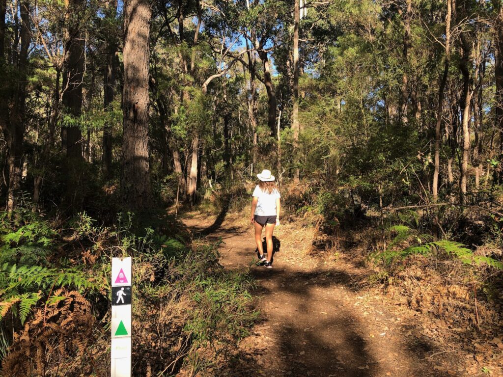
Chimney Trail Loop
Located inside the Wooditjup National Park, the Chimney Trail Loop is a perfect trail for those looking for a quick (about an hour) walk through a beautiful section of the National Park. The 3.3km Chimney Trail Loop begins and ends at the carpark near the Carters Road Trailhead.
It is mostly flat and easy for all fitness levels to manage. It follows Bramley Brook and then veers off, leading you to the giant chimney and past the old Wharncliffe Mill. It’s here that the trail starts looping back through the forest.

Other walks in Wooditjup National Park
McQueen Road Loop
This is generally considered an easy route and is 1.6-km loop trail near Bramley, Western Australia. A nice short hike through the forest in the true heart of Margaret River, within in the Wooditjup (Bramley) National Park.
The trail begins where several others do, from the parking area just off Carters Road, where it intersects with McQueen Road.
Wooditjup National Park from Rusden Picnic Area
Enjoy this 6.4-km out-and-back trail near Margaret River, Western Australia. Generally considered a moderately challenging route, it takes about 2 hours to complete.
This trail is great for hiking, mountain biking, and walking, and it’s unlikely you’ll encounter many other people while exploring. You’ll need to leave pups at home — no dogs allowed.
Wadandi Track
Following the tracks of the Busselton to Flinders Bay Railway, built in 1884, the Wadandi Track is a Rails to Trails trail – it is smooth and evenly graded trail suitable for hikers and cyclists of all skill levels. Rail trails are shared-use paths recycled from abandoned railway corridors.
Usually managed by local councils for the enjoyment of the general public, rail trails can be used for a range of purposes including walking, cycling and horse riding.
In addition to being an excellent place for younger bikers to learn the ropes of off-road biking, the trail is wheelchair accessible during the dry season.
Approximately 22 km long, Wadandi Track traverses through one of the world’s 34 biodiversity hotspots, giving visitors a view of some of Western Australia’s most unique and beautiful flora and fauna, with rich birdlife.
You will also enjoy farmland, vineyards, peppermint, jarrah, and karri forest. The track offers several picnic areas, scenic lookouts, and toilet facilities. Dogs on leads are permitted on the trail.
The track currently begins or ends (depending where you start) at Cowaramup and finishes at Witchcliffe.

Bunnitj Biddi Walk/Cycle Trail (formerly Ten Mile Brook Trail)
Bunnitj Biddi is a walk and cycle trail that winds through forests of karri, marri, jarrah and blackbutt, with peppermint in the wetter areas. Its a moderately easy route out to 10 Mile Brook Dam that takes around 4 hours and is a 15km return trail. Free admission and dogs on leads are permitted.
The Ten Mile Brook Trail starts in the Rotary Park near “Old Kate”, a preserved steam engine at the northern edge of Margaret River. Much of the trail follows old timber tramway formations up the river to the Rusden picnic site at Ten Mile Brook Dam.
The 15 kilometre return trail is a combination of compacted earth and coarse gravel suitable for bikes.

Can I visit the 10 Mile Brook Dam if I am not hiking?
Yes you can! Access to the dam is via the Rusden Picnic area off Rosa Brook Road.
Ten Mile Brook Dam is a lovely picnic area with a barbeque and two accessible picnic tables. It was named after the tiny brook that was dammed in the mid-1990’s to create a new supply of water for the quickly growing Margaret River town.
Nearby there are accessible parking bays and a toilet. The dam is a ten-minute walk from the car park – the track is not accessible for people using mobility devices.
(Don’t get confused with the name, the Big Brook Dam Walk is in Pemberton and is a sealed 4km walk trail that follows the shores of the dam and is suitable for wheelchairs and prams!)
Margaret River Organic Garden
Not a typical walking trail, but nonetheless a place you might want to check out if you are looking for a lovely spot to do some meditation, and soak in some nature. The sprawing gardens at Margaret River Organic Garden are in the middle of the town, with lots of lawns for the kids to run around… O Admission is free, the garden is always open.

Margaret River Heritage Park – Rotary Park
One of the best walking trails is the Margaret River Heritage Trail and Rotary Park along the river. The Heritage precinct is on the town side and includes a group settlement cottage and various interesting historical panels, displays and murals.
Once you cross the bridge, you will see the steam train and an ample playground and exercise equipment. The park has restroom facilities, barbeque and picnic areas, If you feel more adventurous, the Heritage Trail Head is also the starting point of the Ten Mile Brook cycle and walking Trail
Minnie Keenan Trail is a linking trail between Rotary Park and the Wadandi Track (Carters Road Trail head). This moderate trail is only suitable for walkers. An interactive trail map is online and very useful.

More Walking trails in Margaret River
Cape to Cape Track
One of Australia’s top hiking trails, and one that particularly showcases the beauty of the Margaret River region, the Cape to Cape Track runs along a 125 km stretch along the coast of south west Western Australia.
While the track follows the coast and hikes along beaches at some point, it also covers some ground inland so you can enjoy the stunning forests and wildflowers of Western Australia (in season)
This hike an comfortably be hiked in about six or seven days for hikers, with an average fitness level traversing around 20-25 km a day. You can begin at Cape Naturaliste, the northernmost point of the trail or start at Cape Leeuwin at the southern tip.
There are campsites along the track and various exit and entry points for those who prefer to experience just parts of the track. For this author, hoping to get back into multi day hiking after a 10 year child raising hiatus, my plan is to do about half the Cape to Cape (3 days) on my first attempt!

Some of the best sections within easy access from car parks along the coast, making them spectacular coastal walks indeed! Consider the following sections
- Hamelin Bay to Cosy Corner
- Castle Rock to Wyadup Beach
- Smith’s Beach to Canal Rocks
Even if you are doing a short hike, bring fresh water and essential snacks. Any track that takes you along the beach can be quite tough! Note, dogs are not permitted.
Seeking travel ideas and fun activities? Discover what Dunsborough has to offer in our guide!

Quinninup Falls
You are likely to see lots of pictures on the ‘gram of Quinninup Falls, and its true that in mid winter it can have lovely cascade. That said, when my son visited he asked, “is that it?” Even in the middle of winter it was not a huge waterfall… but the 2.5 km hike to the falls is a spectacular section of the Cape to Cape Track and a great opportunity to take in the stunning landscapes that the area is famous for.
Outdated blogs mention that the trail can be muddy and that there are dunes; when we visited the boggy sections had boardwalks, and the one dune is not so big… my 78 year old mother did it just fine.
You can do the complete the trail in less than 1.5 hours, making it one of the best hiking trails in the region.
Dogs are not permitted, and there are no facilities once you leave the carpark – we took snacks and ate them at the falls. Our full review of the Best way to visit Quinninup Falls.
We also have a guide on the best Margaret River waterfalls you should check out!

Tips for bushwalking around Margaret River Region
- Wear suitable, closed-toes footwear
- Slip, slop slap sunscreen on during high UV weather
- Wear a hat
- take a fly net if they bother you, especially in spring
- Bring water: 1 litre per person, per hour
- Do not stray off the tracks
- Be mindful of snakes in spring and summer
- Tell someone where you are going and when you’ll be back

The Verdict – Margaret River Walks and Walking Trails
We hope that this hiking guide gives you some unique insight into some of the top trails in south Western Australia. This brief overview of trails in the Margaret River area gives you an idea of the stunning range of natural beauty both on the coast, and in the forest.
Planning a trip to Margaret River? Make sure you read our Perth to Margaret River road trip guide!


Leave a reply